
50 Structures Destroyed on the Monument Fire
![A corral burning in the Monument Fire on Bell Flat east of Trinity east of Hawkins Bar on August 21. [Photo by Nick Kieselhorst]](https://kymkemp.com/wp-content/uploads/2021/08/Corral-being-burned-on-the-Monument-Fire.jpg)
A corral burning in the Monument Fire on Bell Flat east of Trinity east of Hawkins Bar on August 21. [Photo by Nick Kieselhorst]
Yesterday, as the Monument Fire pushed southward, the Trinity County Sheriff’s Office reissued the Evacuation Orders for the north Hayfork area pushing some residents that had been hesitant to leave to pack and go. The fire is expected to be active towards Hayfork today with a possibility of dangerous spot fires towards the late afternoon and early evening.
According to the Shasta-Trinity National Forest Public Affairs Office,
The Monument Fire is currently estimated at 152,125 acres with 20% containment. That’s an increase of just over 2,000 acres from Monday. The North Zone acreage is 103,792 acres and South Zone is 48,334 acres.
While there was increased fire activity in the South Zone around the community of Hayfork Monday night, there was little action on the North Zone as firefighters continued to patrol and hold control lines in all Divisions. However, fire activity could increase today as south/southwest winds are expected to clear smoke out on the west and south sides.
A blanket of smoke and light winds over the fire the past several days has kept fire behavior docile for the most part but there is potential, given the extremely dry conditions, for the fire to become more active when the smoke cap lifts. Fresh air could energize the fire and increase the likelihood of spot fires. Resistance to control remains high as fuels continue to be critically dry.
“It doesn’t take much wind,” Operations Section Chief Karen Scholl advised firefighters during Tuesday’s morning briefing. “Any kind of embers outside the (containment) line are going to find receptive fuel beds.”
The three high-priority areas fire managers are focusing on in the North Zone are:
- The northwest corner of the fire near Hawkins Bar and Trinity Village, where the fire continues to back down the west side of Ironside Mountain toward the New River. Fire managers are trying to prevent the fire from spotting across the river and becoming established in the Bell Flat area where it could threaten the two communities.
- The south side of the fire in the Pattison Ridge area west of Hayfork and north of Hyampom Road, where the fire could move west and threaten the community of Hyampom.
- The north side of the fire in the area of the North Fork Trinity River and East Fork Road, where the fire has potential to grow to the north and east, potentially threatening the community of Weaverville.
Crews continue to open up dozer lines in all three areas put in for previous fires. Those dozer lines will be used as control lines, if needed. Crews have opened up more than 66 miles of dozer line and constructed more than 4 miles of hand line. There are currently almost 142 miles of uncontained fire edge on the fire.
A community gathering was held in Hyampom on Monday to keep residents there abreast of plans to protect that community. Fire managers are establishing a small spike camp at the Bar 717 Ranch east of Hyampom for firefighters to base out of and help keep the community informed.
With evacuation orders being reduced to warnings for Junction City, Canyon Creek Road and the Highway 299 corridor communities of Big Bar, Big Flat and Burnt Ranch on Monday, people returning to their homes are asked to be extremely cautious of firefighters and firefighting apparatus along the roads. Motorists should drive with their headlights on at all times.
Information from Cal Fire:
The fire line near Junction City remains in patrol status and some evacuation orders have been reduced to evacuation warnings allowing residents to repopulate in some areas. In the Dutch Creek drainage, crews will strengthen the fire line and continue tactical patrol. Steep terrain and limited access from Dutch Creek to Maxwell Creek is impeding firefighter efforts as burning debris rolls down-slope creating spot fires across the fire line. From Maxwell Creek to the Barker Creek Road area, crews continue to construct fire line and eliminate pockets of unburned fuel. Near Barker Creek to Cedar Gulch, the fire perimeter is holding at the fire line and crews will strengthen the line and patrol the area. West of Cedar Gulch, crews continue to chase and contain spot fires while constructing fire and contingency lines.
Warming and drying conditions will continue today while dense smoke partially clears in the afternoon hours in the Hayfork area. Stronger terrain driven winds are expected late afternoon into early evening and will diminish overnight with moderate humidity recovery.
Northern California has experienced large fire activity and will likely experience an extended fire season. Fires burning in northern California are exhibiting extreme fire growth based on critical fuel conditions. The prioritization of resources is always based on life, property, and natural resources. Under these drought conditions, wildfires are burning rapidly with extreme severity and have traveled up to 8 miles in a single day. Fire spread is fuel driven and does not depend on wind speed, as we have seen in previous years. Firefighters are experiencing conditions never seen before, such as increased spread rates, spotting and active nighttime burning. We coordinate very closely with the US Forest Service and CalOES for our local and out of state partners, to ensure resources are shared.
**A new Fire Information line has been established for the South Zone of the Monument Fire. Please call (949) 433-2638.**
We’ve gathered the most important information about the Monument Fire and organized it below for our readers.
Stats:
1,798 personnel, 26 hand crews, 145 engines, 14 helicopters, 51 dozers, 22/33 water tenders (discrepancy between the Forest Service reporting 22 and Cal Fire reporting 33), 5 skidgines, 3 excavators.
Compelling Images:
![the Monument Fire on Bell Flat east of Trinity east of Hawkins Bar on August 21. [Photo by Nick Kieselhorst]](https://kymkemp.com/wp-content/uploads/2021/08/237079500_10158446628189537_542934716118208050_n.jpg)
Farming equipment burning on the Monument Fire on Bell Flat east of Trinity east of Hawkins Bar on August 21. [Photo by Nick Kieselhorst]
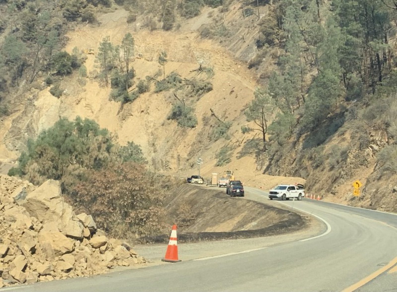
Highway 299 is closed. Hazards exist along the route. To ensure the safety of the general public, the road will remain closed until the hazards are mitigated. [Photo and caption from InciWeb]
The Plan:
The east section of the Monument Fire (Cal Fire):
The west section of the fire (National Forest Service):
https://www.facebook.com/ShastaTrinityNF/posts/3058265011072204
The Weather:
According to the Shasta-Trinity National Forest Public Affairs Office,
Widespread morning smoke blanketing the fire will disperse some into the afternoon with daytime heating and southerly transport winds. A few ridgetop cumulus clouds may form. High temperatures will warm into the upper 70s to low 90s. Low level west-northwest winds in the late afternoon and early evening will once again press updrainage through the Trinity River basin with gusts near 20 mph at times. Minimum humidity will range from the upper teens to near 30%.
The Roads:
This morning, Caltrans QuickMap and the CHP Traffic Incident Information Page are still reporting that the western edge of the closure on Hwy 299 at Pony Creek Road west of Burnt Ranch and the eastern closure is now 1.6 miles east of Junction City at mile marker 45. However, if fire conditions continue to be favorable, look for Hwy 299 to open or at least partially reopen.
In addition, Cal Fire reports, “Dutch Creek Road at Red Hill Road. Dutch Creek Road, Evans Bar and Solider Creek will remain closed. Highway 299 at Sky Ranch Road. Highway 299 at Ammon Road. Both road closures are open to residents and emergency responders only. East Fork/ Helena Road. All of Big French Creek Road north Highway 299 and the area north of the residences on Big Mountain Road will remain closed.”
The Maps:
- Operations Map –to see details either zoom or click on the map and download a pdf.

- KMZ Map–Zoom for detail or for 3D imagery, click on the map and download a file that connects with your Google Earth program.

Evacuation and Help Information Including Community Meetings:
- Community Meetings: A virtual community meeting will be held at 6:00 P.M. Wednesday, August 25th, 2021. The meeting will be live streamed on the CAL FIRE Shasta-Trinity Unit Facebook page, CAL FIRE IMT 5’s YouTube channel and Shasta Trinity National Forest Facebook page.
- Evacuation Centers are at
- The American Red Cross has a shelter for #DixieFire and #MonumentFire evacuees at Shasta College, 1155 Old Oregon Trail, Building 1900, #Redding, CA.
- There is a shelter at Willow Creek Bible Church, 39 Barannan Mountain Road, Willow Creek, CA 95573.
- Trinity County Fairgrounds announced, “Evacuees: The Fairgrounds is currently Open, if you have vehicles, boats, trailers, etc. that you would like to move to our parking lot please complete a form, located on our bulletin board and put into the mailbox. Everyone is welcome to use this space if you feel it is safer than your property.”
- Areas under Evacuation Warning are
- Burnt Ranch
- Cedar Flat
- Coopers Bar
- Douglas City
- Hayfork–South section (See here for details)
- Junction City east to Oregon Summit including (See here for details):
- La Grange Road
- Canyon Creek Road North to Ripstein Campground
- Castle Road
- Red Hill Road
- Slattery Gulch Road
- In effect for Weaverville, Douglas City, areas south from Barker Mountain
- Areas under Evacuation Orders are:
- Areas Northwest of the Hayfork Summit (See here)
- Dutch Creek
- Hayfork–north section (See here for details)
- Sky Ranch Road (road closure at SR 299 at Sky Ranch Road)
- Anyone impacted by wildfires in Trinity County can receive free referral support, group support, and one-on-one crisis intervention by reaching out to (530) 461-0257 and [email protected].
- According to the Trinity County Animal Shelter, “If you are being evacuated and need help moving or a place to take large animals please call either the sheriffs office at 530.623.2611 or us here at the shelter at 530.623.1370.” More information here: Animal Shelter Evacuation Information From the Trinity County Sheriff’s Department
- In addition, Domestic + Large Animals can be taken to the Hoopa Rodeo Grounds on Pine Creek Rd in Hoopa, CA. Click here for a map.
- Redding Rodeo Grounds (large animal) 715 Auditorium Drive Redding, CA
- Trinity County Animal Shelter, 563 Mountain View St, Weaverville, CA
- Warehouse (small animal) 145 Locust Street Redding, CA
- Mandatory evacuations caused by fast moving wildfires in the local area have resulted in the temporary closures of several Trinity County Post Offices. Customers impacted by these closures may pick-up mail at alternative locations. See details below:

Earlier Chapters:
- Evacuation Warnings Issued for Del Loma Area Along Hwy 299; 1000 Acres and 0% Contained
- Hwy 299 Closed at Big Bar Due to the Monument Fire
- Hwy 299 Reopens, But ‘Subject to Closure at Any Time’
- Trinity County Sheriff Issues Evacuation Orders Tonight in Big Bar Area as Monument Fire Grows; Hwy 299 Closed!
- Breakout Spots From the Monument Fire Crossed 299 and Trinity River, Threaten Structures
- [UPDATE 6:52 p.m.: Monument Fire Now 9000 Acres, 0% Contained] Evacuation Order for Cedar Flat and Evacuation Warning for Burnt Ranch Areas Along Hwy 299
- Monument Fire’s Behavior Causes Sheriff to Issue Evacuation Warning for Big Flat
- Monument Fire Grows Another 6000 Acres, Now at 15,000 and 0% Contained
- Monument Fire Grows Over 2500 Acres Today
- About 240 Customers Without Power as the Monument Fire Continues to Disrupt the Lives of the Small Communities Along Hwy 299
- Monument Grew Another 7000 Acres to Almost 25,000 and Remains Uncontained
- Evacuation Warning For Helena, Junction City, Coopers Bar, Red Hill, and Canyon Creek
- Trinity County Sheriff Issued an Evacuation Order for Big Flat
- Monument Fire: New Evacuation Orders and Warnings as Fire Ramped Up Activity Today
- Structures in the Tiny Tourist Town of Big Flat Burned as Monument Fire Swallows Another 10,000 Acres, Still 0% Contained
- Trinity County Sheriff’s Office Issues Evacuation Order for Helena
- Monument Fire Grows to 42,567 Acres, Still 0% Containment
- Spot Fire Northwest of Junction City
- Monument Fire Just Under 50,000 Acres and 0% Contained as It Spread Quickly Overnight
- Monument Fire Surpasses 50,000 Acres
- Evacuation Order Issued for Burnt Ranch Area
- Temporary Evacuation Point Set Up for Evacuees From the Monument Fire
- Monument Fire Captures Just Under 58,000 Acres, Firefighters Hold at 3% Containment
- Thirty-One Structures Destroyed so Far as the Monument Fire Takes 62,490 Acres
- After a Night Where the Fire Grew a Mile to the East in One Area, Red Flag Warning Will Challenge Crews Battling the Monument Fire Today
- Red Flag Conditions Again Today as Monument Fire Closes in on 75,000 Acres With Only 5% Containment
- Monument Fire Swells Another 4000 Acres; Containment Remains at 5%
- Wind and Hot Dry Temperatures Could Challenge Crews on the Monument Fire Particularly on the East Side Today
- The Trinity County Sheriff’s Office Issued an Evacuation Order on the Monument Fire for Sky Ranch Road
- Leaping Almost 15,000 Acres Since Yesterday, the Monument Fire Closes in on 100,000 Acres
- As Monument Fire Grows, Trinity County Sheriff’s Department Issues an Evacuation Warning for Wildwood Road to Hayfork Summit
- New Evacuation Orders Issued on the Monument Fire (MAP)
- Monument Fire Roars Over Another 22,000 Acres in the Last Day
- Smoke From Fires Cooled Temperatures and the Monument Fire Had a Calmer Day Than Expected
- Monument Fire Continues to Push Towards Hayfork, Growing Almost 7000 Acres Overall
- Monument Fire Grows About 6000 Acres; With the Wind Changing, the Fire Is Expected to Move to the West Today
- Two Spot Fires From the Monument Fire Jumped the New River This Evening
- Monument Fire Claws It’s Way West But Firefighters Up Containment in Other Areas of This Massive Beast
- Monument Fire Grew Another 2000 Acres in the Last Day, Containment Remains at 16%
- Monument Fire Containment Increases to 20% After Another Day of Heavy Smoke Suffocating the Flames
- Monument Fire Tops 150,000 Acres, Pushes Towards Being in the Top Twenty Largest Wildfires in California History
- Big Flat, Big Bar and Del Loma Reduced to an Evacuation Warning
- Junction City Reduced to an Evacuation Warning
- Burnt Ranch Reduced to an Evacuation Warning on the Monument Fire
- The Monument Fire Active North of Hayfork Tonight
Join the discussion! For rules visit: https://kymkemp.com/commenting-rules
Comments system how-to: https://wpdiscuz.com/community/postid/10599/
And just think. If they had put their “resources”, on Day 1, to put this out, so much heartache would have been prevented. I hope that we all realize it’s time for a change in how the USFS is managing our forests. With a big step up in preparedness. (Well, we’ve realized that for some time actually. )
I have to hope that change is possible. we all need to get on board.
So much sacred spaces burning
No air to breathe- again
So much loss.
So much anxiety.
So much sadness.
Yes I agree. This can’t be the new normal. People can’t live like this every year. It’s time to get our state government to develop a serious system that detects and attacks these fires immediately. If they can see our plants in our backyard in real time, they sure as shit can find a fire when it starts.
They can also start spending a lot more money on fuel reduction near our towns and populated areas.
This is why we have government- to deal with things that are bigger than we are as isolated communities. I have no problem paying my taxes and asking the government to do things they should be doing.
This is unacceptable- people can’t live like this. The economy can’t function like this. No fire insurance, no property sales.
It’s time for a solution.
Right on Willow Creeker.
When we get past this (?? )
I think that we have to get proactive.
There’s ideas. Crews ready in each divisions in each forest. Helicopters stationed permanently in key locations and so many ideas.
This could have been stopped the first day. We have the technology to pinpoint every lightening strike. There needs to be a restructuring.
I hope for change.
I’m encouraged by the communities along the rivers.
USFS forest management project is going well it looks like management projects that burn mass amounts of acreage and burn structures ??Good job Shasta Trinty & Six Rivers
50 structures is a big hit for this tiny community along the river. I suspect there are other losses that aren’t accountable. I know, for me, this fire has cost me about $10k. Multiply that by the few thousand that got directly hit and this little community lost millions in dollars and untold amounts in in physical and emotional strain. I am sorry for everyone’s losses. I hope, moving forward, we rebuild with a better sense of awareness of how these wild land around us can effect our existence.
I hope, moving forward, that we rebuild with homes that are hardened to resist ignition by wind borne embers: https://legacy-assets.eenews.net/open_files/assets/2019/01/08/document_gw_02.pdf Check out figures 6 & 7, and 9a & 9b. It’s been shown that with new construction, a fire hardened home does not need to cost more:
https://headwaterseconomics.org/wp-content/uploads/building-costs-codes-report.pdf