
Monument Fire Captures Just Under 58,000 Acres, Firefighters Hold at 3% Containment
![Monument Fire on August 10 by Cedar Flats. [Photo by Paul Turner]](https://kymkemp.com/wp-content/uploads/2021/08/unnamed-2021-08-10T095620.092.jpg)
Monument Fire on August 9 by Cedar Flats. [Photo by Paul Turner]
Information from the Shasta-Trinity National Forest Public Affairs Office:
Current Situation: Our night resources were hard at work securing and defending structures and reinforcing indirect lines. There was moderate fire activity on all flanks of the fire, backing downhill. Firefighters continued to engage the fire as it backed downhill around the East Fork Road in Helena.
On the southeast side of the fire, conditions were favorable for proactive firing operations along roadways and dozer lines, allowing the backfire to consume fuels between the control line and main body of the fire. This action is intended to reduce the threat of any future long-range spotting. …
Life safety is at the forefront of our mission and preserving homes and structures where fire threatens communities. Fire crews will stay vigilant and continue to secure and defend those structures. Firefighters have deployed hose lines and continue to mop –up around the fire’s edge and along private properties and values of risk. Crews from CAL FIRE assisted our crews in improving dozer and hand lines in communities on the western flank of the fire.
Today dry fuels, steep topography, and upslope winds will remain the primary drivers to fire movement. With more anticipated hot, dry weather and shifting winds this week, the potential exists for fire crews to experience extreme fire activity. Crews will scout and monitor the perimeter as fire behavior may present them with uphill runs and long-range spotting during the heat of the day. We have five helicopters assigned to the Monument Fire who are mobilized and ready to fly. When there is heavy, low-lying, dense smoke, visibility is limited, and aircraft must remain on the ground for the safety of our crews.
As soon as the skies clear, we launch our air attack team to drop water and retardant to slow the fire’s progression, allowing ground crews to engage the fire safely. We are working diligently to return residents back into their communities as soon as safe to do so, and we appreciate your support and patience while we work to suppress the Monument Fire.
We’ve gathered the most important information about the Monument Fire and organized it below for our readers.
Stats:
684 Total Personnel, 7 hand crews, 70 engines, 5 helicopters, 10 dozers, 2 water tenders and 5 masticators
The Plan:
https://www.facebook.com/ShastaTrinityNF/posts/3047785995453439
Compelling Images:
![Monument Fire on August 10 by Cedar Flats. [Photo by Paul Turner]](https://kymkemp.com/wp-content/uploads/2021/08/unnamed-2021-08-10T095638.144.jpg)
Monument Fire on August 9 by Cedar Flats. [Photo by Paul Turner]
![Monument Fire on August 10 by Cedar Flats. [Photo by Paul Turner]](https://kymkemp.com/wp-content/uploads/2021/08/unnamed-2021-08-10T095629.769.jpg)
Monument Fire on August 9 by Cedar Flats. [Photo by Paul Turner]
The Weather:
The weather will be hot and dry today. Firefighters are bracing for a rough go as temperatures could be up to 105 degrees and humidity could drop as low as 8%. Winds could gust up to 15-20 miles per hour further complicating the firefighters task.
The Roads:
Caltrans states, “State Route 299 in Trinity County is currently closed from approximately 4 miles west of Burnt Ranch to approximately 7 miles west of Weaverville, near Junction City. There is currently no estimated time for when the roadway will be reopened.”
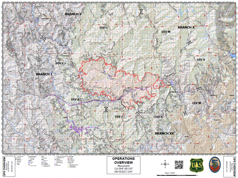
The Maps:
- Public Information Map-2021_08_08-07.42.51.749-CDT
- Operations Map –to see details either zoom or click on the map and download a pdf.
- KMZ Map–Zoom for detail or for 3D imagery, click on the map and download a file that connects with your Google Earth program.

Evacuation and Help Information Including Community Meetings:
- A virtual public meeting will be held Thursday evening via Facebook Live on the Shasta-Trinity National Forest page.
- Evacuation Centers are at
- The American Red Cross is opening a shelter for #DixieFire and #MonumentFire evacuees at Shasta College, 1155 Old Oregon Trail, Building 1900, #Redding, CA.
- Evacuation Center on western side of the fire:
Trinity Velley Elementary School, 730 California 96, Willow Creek, CA 95573
- Areas under Evacuation Order are:
- Big Bar
- Big Flat
- Burnt Ranch
- Canyon Creek
- Cedar Flat
- Coopers Bar
- Del Loma
- Helena
- Junction City
- Red Hill
- Anyone impacted by Wildfires in Trinity County can receive free referral support, group support, and one-on-one crisis intervention by reaching out to (530) 461-0257 and [email protected].
- According to the Trinity County Animal Shelter, “If you are being evacuated and need help moving or a place to take large animals please call either the sheriffs office at 530.623.2611 or us here at the shelter at 530.623.1370.” More information here: Animal Shelter Evacuation Information From the Trinity County Sheriff’s Department
Earlier Chapters:
-
- Evacuation Warnings Issued for Del Loma Area Along Hwy 299; 1000 Acres and 0% Contained
- Hwy 299 Closed at Big Bar Due to the Monument Fire
- Hwy 299 Reopens, But ‘Subject to Closure at Any Time’
- Trinity County Sheriff Issues Evacuation Orders Tonight in Big Bar Area as Monument Fire Grows; Hwy 299 Closed!
- Breakout Spots From the Monument Fire Crossed 299 and Trinity River, Threaten Structures
- [UPDATE 6:52 p.m.: Monument Fire Now 9000 Acres, 0% Contained] Evacuation Order for Cedar Flat and Evacuation Warning for Burnt Ranch Areas Along Hwy 299
- Monument Fire’s Behavior Causes Sheriff to Issue Evacuation Warning for Big Flat
- Monument Fire Grows Another 6000 Acres, Now at 15,000 and 0% Contained
- Monument Fire Grows Over 2500 Acres Today
- About 240 Customers Without Power as the Monument Fire Continues to Disrupt the Lives of the Small Communities Along Hwy 299
- Monument Grew Another 7000 Acres to Almost 25,000 and Remains Uncontained
- Evacuation Warning For Helena, Junction City, Coopers Bar, Red Hill, and Canyon Creek
- Trinity County Sheriff Issued an Evacuation Order for Big Flat
- Monument Fire: New Evacuation Orders and Warnings as Fire Ramped Up Activity Today
- Structures in the Tiny Tourist Town of Big Flat Burned as Monument Fire Swallows Another 10,000 Acres, Still 0% Contained
- Trinity County Sheriff’s Office Issues Evacuation Order for Helena
- Monument Fire Grows to 42,567 Acres, Still 0% Containment
- Spot Fire Northwest of Junction City
- Monument Fire Just Under 50,000 Acres and 0% Contained as It Spread Quickly Overnight
- Monument Fire Surpasses 50,000 Acres
- Evacuation Order Issued for Burnt Ranch Area
- Temporary Evacuation Point Set Up for Evacuees From the Monument Fire
Join the discussion! For rules visit: https://kymkemp.com/commenting-rules
Comments system how-to: https://wpdiscuz.com/community/postid/10599/
Stay safe everyone
Glad to hear that Trinity Valley Elementary will now be a shelter. That is good!
Be Safe All!!
She is no joke.
I was entrenched with the Iron Mtn Hand Crew and Lava Beds Engine crew on my property in the Price Creek drainage in Big Bar for 3 days. Assisted in fighting it back and doing a 360* back burn around my entire property perimeter. We saw some explosive fire behavior when the NW winds picked up during our backburn. Humbling experience. Stay safe, if you are in doubt or not confident in your ability to stay aware of the situation, topography, winds and fire behavior, do not hesitate to evacuate!
Thoughts and prayers to all, condolences to those that have suffered losses.
Glad you are safe and thanks.
Good words of wisdom.
Iron Mt Hand Crew, Price Creek drainage, Big Bar
I’m curious about your interesting banner 🙂 Nice pics, hope your in the black and a bit safer now.
It’s a Widespread Panic shirt. ‘Good People’ is one of the bands original songs.
“We are the good people, the ones your friends told you all about. One touch of nature digs your whole world again.”
Seemed fitting to put up by the Iron Mtn Hand Crew rig, they are some good folks!
Awesome! My wife grew up in New Jersey and her and her friends used to drive into the city and party at the Wetlands, she saw Widespread Panic and Blues Traveler before they ever did a stadium show at that place. When she went off to collage at UVM Phish played at the campus quad and at Nectar’s in downtown Burlington. She was very lucky, around that time i was stuck out here on the west coast occasionally taking in a Dead show in the bay. What’s hilarious is she’s never been to a Dead show, lol. Glad you got the help you needed around your property. Stay safe!
Candlesticks
View of Monument Peak looking W/SW
Thank you firefighters!
Thank you neighbors!
Kym, do you have a site which lists USFS and county road closures for this fire? Inciweb has really dropped the ball and lists no road closures… even 299. Thank you.
I’m Ok but stuck in the middle of this.
I don’t and it has been bugging me. This is my best source. https://twitter.com/TrinityDOT
Thanks. Pretty minimal information. I assume you have the ftp site. Does that have any closure maps? I haven’t plowed through all the directories.
This seems like such a simple and essential service from the county or USFS.