
Red Salmon Fire Grew to Just Under 48,000 Acres and Was Advancing to the Southeast Last Night

Red Salmon firing operations. [Photo from InciWeb]
Overnight, the fire continued to advance making “significant movement” to the southeast, according to the Northern California Geographic Coordination Center.
“The fire is actively backing into Tish Tang Creek, creating alignment for potential fire runs into Hoopa tribal lands. Firefighters continued to patrol the northeast portion of the fire along Nordheimer Creek and China Creek,” according to InciWeb.
Yesterday, it moved out of the designated wilderness and thus, can be fought with more intensive fire suppression efforts.
Fire activity remained active most of the night with significant movement of the fire to the southeast.
In Brief:

The Plan:
According to Inciweb, “Fire crew efforts will be focused today clearing dozer lines created during the Corral Fire of 2013, near the fire perimeter in the southwest area of the fire. Tactical firing operations will continue along 10N02 Road, which serves as a primary line containing the fire east of the Hoopa Valley Reservation.”
Compelling Imagery:

Red Salmon stacking smoke yesterday evening. [Image captured from AlertWildfire]
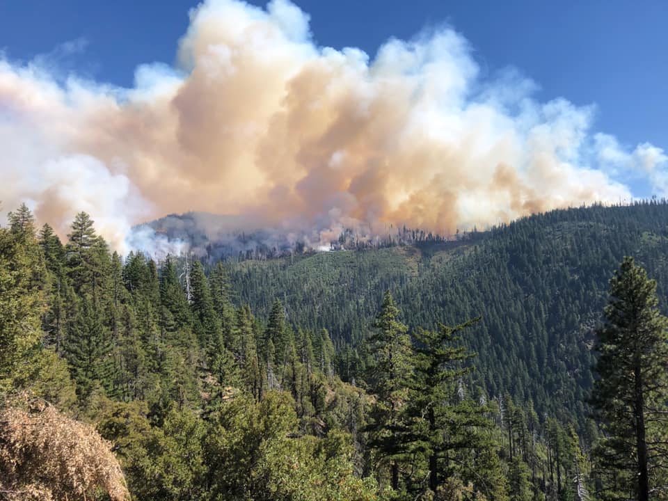
[Photo by Jeff Hinson, Division CA Team 14]

[Photo by Jeff Hinson, Division CA Team 14]
The Weather:
According to InciWeb,
A dry cold front moved into the area from the north and east, bringing the potential to produce critical fire weather conditions with an east wind over the fire area. The expected winds did not materialize over the fire area last night; however, those winds are expected to increase throughout the day and remain a threat into Wednesday afternoon. A Red Flag Warning is effect from Monday night at 10 p.m. and has been extended until Wednesday at 12 noon.
The Closures:
According to InciWeb,
The US Forest Service Pacific Southwest Region announced yesterday the closure of all developed campgrounds and day-use sites on National Forests in California. Additionally, the prohibition of the use of any ignition source on all National System Lands (campfires, gas stoves, etc.) throughout California. The Red Salmon Fire Forest Closure Area became effective on August 8, 2020 under Forest Supervisor’s orders on the Klamath, Shasta-Trinity, and Six Rivers National Forests. As hunting seasons open, hunters are reminded the closure is in place for their safety as well as the safety of firefighters. Complete closure information is available on InciWeb for the Red Salmon Complex.
The Maps:
- Operations Map –to see details either zoom or click on the map and download a pdf.

- KMZ Map–Zoom for detail or for 3D imagery, click on the map and download a file that connects with your Google Earth program.
 20200908_RedSalmon_IR (1)
Earlier Chapters:
- Red Salmon Complex Nearly 4,000 Acres, Still 0% Containment
- Red Salmon Complex Still 0% Contained
- Red Salmon Complex Now Over 3,300 Acres With 0% Containment
- Red Salmon Complex Now at 2,643 Acres With 0% Containment
- The Red Salmon Complex, Burning in Humboldt, Trinity, and Siskiyou Counties, is Now Over 1000 Acres With 0% Containment
- The Salmon Fire and the Red Fire Are Being Managed as a Complex [MAP]
- Salmon Fire Started Yesterday, July 28, and Is Estimated to Be 220 Acres and Have 0% Containment
- Red Salmon Complex Grows to 4,284 Acres With 5% Containment
- Cooler Temperatures and High Humidity Kept Red Salmon Fire From Expanding
- Hotter, Drier Weather This Weekend Could Lead to ‘Significant’ Growth on Red Salmon Complex
- Red Flag Warning Issued for the Red Salmon Fire Area
- Red Salmon Complex Now Over 7000 Acres; Red Flag Warning Today
- Red Salmon Complex Now Over 8,000 Acres; 35% Contained
- Red Salmon Complex Now Over 8,000 Acres; 35% Contained
- The Red Salmon Complex Now 10,178 acres and 35% Contained
- Red Salmon Complex Now Over 12,000 Acres
- Red Salmon Complex Now Over 15,000 Acres
- Red and Salmon Fires Burn Together Above Red Cap Lake
- Red Salmon Fire Now Over 16,000 Acres
- Red Salmon Complex Now Over 18,000 Acres
- Red Salmon Complex Jumps to Just Under 19,000 Acres
- Red Salmon Complex Nearing 20,000 Acres
- Red Salmon Fire Now Over 20,500 Acres
- Red Salmon Fire Almost 30,000 Acres, Spotted Over Containment Lines
- Red Salmon Complex Now at 37,638 Acres
- Red Salmon Complex, Which Is Burning in Three Counties, Grew 1500 Acres in the Last Day


Join the discussion! For rules visit: https://kymkemp.com/commenting-rules
Comments system how-to: https://wpdiscuz.com/community/postid/10599/
Crap. Those spots to the southeast are going to add 20k acres to the fire.
20k? More like another 50k. Only a matter of time until it crosses the East Fork New River and heads up over Jim Jam Ridge and Limestone Ridge. At that point, the whole of the Alps is for the taking if it doesn’t stop at either of those ridges.
I think you’re getting ahead of yourself a bit. There’s a lot of country between the fire and East Fork… and quite a few ready made fire breaks.
Maybe, maybe not. With our extremely dessicated conditions and sustained east winds, today the Bear Fire east of Oroville ran about 14 miles (as the crow flies) to Berry Creek and Forbestown. Jumping roads, old firebreaks, ridgelines, and the Middle Fork of the Feather.
If we get a sustained northwest wind event, which are commonly the prevailing wind events in systems heading down from the Gulf of Alaska, we could be looking at a similar scenario. I measure the distance from the southeast spotting to Junction City as about 21 miles as the crow flies…
For the past few days I’ve been revisiting my post-Helena Fire firebreak west of the house, removing regenerating oak brush and dropping a couple of undesirable madrones. Recall the 2008 fire season (lightning caused), when over 220,000 acres burned across Trinity County alone. And it wasn’t even close to as dry as it is now. Doesn’t hurt to be prepared, rather than flailing at the last minute.
I agree. It’s good to be prepared and have a plan. And an ignition source could come from anywhere.
The bear fire and the slater fire are showing how devastatingly quick the fires can be right now.
In the beginning of the fire they were out there doing wild land fire training excercise and wild land fire scientific research.There should be no reason at all for the growth of the red salmon fire now Hupa and wc salyer Hawkins bar Trinity village burnt ranch are now in danger of burning abosulte bull crap
You are absolutely correct! We have watched year after year them monitoring the fires instead of putting them out. And their back fires do more harm than good. We have a friend in Trinity County whose neighbor allowed the forest service to set a back fire on his property after being told they would stay all night and keep it under control, but forest service left and the neighbors fought the fire and then the forest service had the nerve to ask our friend if they could set a back fire on his property. We have talked to people who work for the forest service and they are not allowed to do everything possible to put out fires.
If you look at the Northern California Geographic Coordination Center page under intelligence and then news and notes you would see that as of this morning the acreage was over 58000.
With all of the fires this year and I have been here in the past where all the roads are closed from fires, floods, slides and demonstrations, I’m going mail my election ballots via air mail.
Ballots?