
With Water Levels So Low at Lake Shasta, Closures and Restrictions in Place
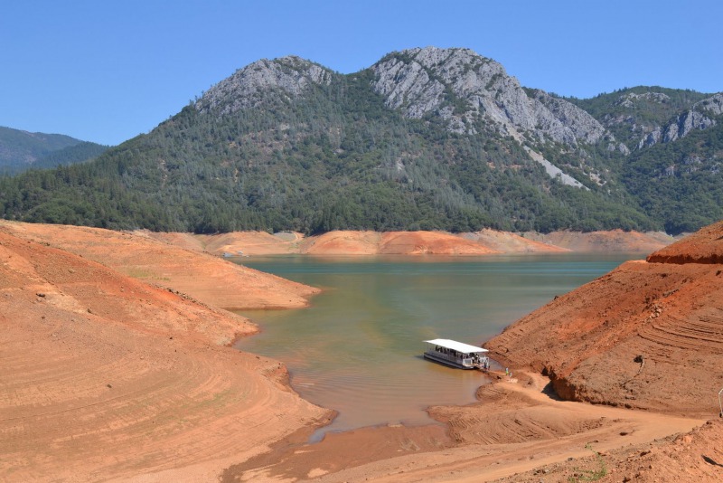
2015 view of Shasta Lake [Photo by Oleg Alexandrov – Own work, CC BY-SA 4.0 via WikiCommons]
As we approach Memorial Day Weekend and enter the summer boating season, the Shasta County Sheriff’s Office is reminding the public of the following closures/operation restrictions on Shasta Lake issued during the 2020 boating season. Because water levels at Shasta Lake remain low, these orders will remain in effect in the interest of continued public safety.
Our primary concern is for the enjoyment and safety of those who recreate on this waterway and have identified the following safety concerns during years with low water storage in Shasta Lake. These restrictions will be in place each year and will go into effect as water levels dictate. As of the morning of May 26, Shasta Lake is currently more than 107 feet down from the top making all the following restrictions valid:
Sacramento Arm:
Salt Creek Inlet – “No Ski” buoys will be located at the entrance to the inlet. The inlet will be closed to all towing activities when water levels reach 70’-80’ down from the high water mark/line.
Gooseneck Cove/Little Sugarloaf Creek – “No Ski” buoys will be placed closing the entire North end of the Sacramento Arm to all towing activities. This will be in effect when water levels reach 90’-100’ down from the high water mark/line.
Sugarloaf Marina/Antlers Marina – “5MPH” buoys will be positioned just south of the marinas and limit speed for the entire north end of the Sacramento Arm. “5MPH” will be the maximum speed north of Sugarloaf Marina for all vessel traffic when the water reaches 90’-100’ down from the high water mark/line.
McCloud Arm:
Dekkas Rock – “No Ski” buoys will be placed closing the entire North end of the McCloud Arm to all towing activities above Dekkas Rock. This will be in effect when water levels reach 90’-100’ down from the high water mark/line.
Squaw Creek Arm:
Chain Gang Gulch – “No Ski/5MPH” buoys will be positioned closing all towing activity and requiring operation of 5MPH north to the end of the Squaw Creek Arm. This will be in place when water reaches 90’-100’ down from the high water/mark line.
Pit River Arm
Jones Valley Inlet – “No Ski/5MPH” buoys will be positioned at the entrance to the inlet, restricting the entire cove to no waterskiing and reduced speed. This will be in affect when water reaches 90’- 100’ down from the high water mark/line.
Shasta County Ordinance 12.24.070 – Waterskiing restrictions; The Sheriff is authorized to close those portions of Shasta Lake to waterskiing upon his findings that waterskiing in such areas is hazardous. Such closures shall be effective from and after the placement of buoys declaring, the area closed.
Shasta County Ordinance 12.24.090 – A vessel must limit its speed to 5 mph within 100 feet of any shoreline or anchored vessel, or within 200 feet of a permanent launch ramp, boat dock or moorage area.
Harbors and Navigation Code 651 (bb) – defines water skiing as the use of water skis, an aquaplane, or similar device. It includes all forms of water skiing, barefoot skiing, skiing on skim boards, knee boards, or other contrivances, parasailing, ski kiting, or any activity where a person is towed behind or alongside a boat.
The Shasta County Sheriff’s Office appreciates everyone’s compliance with the above restrictions and wants to remind you that we are all responsible for safe boating and recreation on the water. If you have any questions regarding these restrictions, contact us at the Shasta County Sheriff’s Office Boating Safety Unit
(530) 245-6075
Join the discussion! For rules visit: https://kymkemp.com/commenting-rules
Comments system how-to: https://wpdiscuz.com/community/postid/10599/
People please be safe and follow all the necessary rules. Enjoy what water is left for now.
So please explain with such a water shortage in the lake why the water releases out of the lake have been so high. I hear it’s for the fish?
You are talking about Lewiston dam, not Shasta
Hydroelectric power !
Have a trip planned the end of August to houseboat on Shasta. Recommend I cancel? Will there be any water?
Better get a raincheck from the resort, but I believe you will be OK.
We are in the Same situation, Planning a trip on a houseboat August 28th, Trying to decide if we should postpone until 2022.
I don’t know if the water is ever going to come back if they keep Geo engineering