
[UPDATE: NWS Says More Coming!] Hail, Yeah!
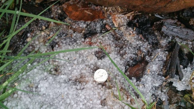
Hail in Whitethorn about 7:40 a.m. [Photo by Laura Lassiter]
Lightning, check.
Rain, by the bucketfuls…check.
Wind, oh, yeah, check.
Hail, definitely, check.
At 6:59 this morning the National Weather Service issued a Special Weather Statement for southwestern Humboldt and northwestern Mendocino Counties.
A line of thunderstorms was moving across the area extending from 15 miles west of Albion to Myers Flat. The NWS warned of the possibility of dime-sized hail, isolated lightning strikes, heavy rains, and winds of around 40 miles per hour.
Several readers reported ponding on roads, hail (not dime-sized, thank goodness), lightning, thunder and high winds. We’re still seeing some ongoing effects in Southern Humboldt as of 8 a.m. though they are subsiding. Rain is no longer torrential just heavy.
Residents of northern Humboldt are still reporting occasional lightning and thunder.
What are you seeing?
UPDATE 8:39 a.m.: The National Weather Service is predicting another line of storms hitting our area. This second line is predicted to be less intense but still worthy of note.
Another line of t-storms moving onto redwood coast. Not as strong as the earlier line, but lightning, gusts to 45, pea sized hail possible.
— NWS Eureka (@NWSEureka) February 19, 2016
They are asking for your weather reports. “Time and Date, Location and Elevation, and the Weather Condition. Images that correspond with the weather report are always appreciated as well,” requested their Facebook page about 8:30 a.m. Go here to make your report.
Join the discussion! For rules visit: https://kymkemp.com/commenting-rules
Comments system how-to: https://wpdiscuz.com/community/postid/10599/
Thunder started in cc about an hour ago. Lots of it.
On this lightning map which is reasonably accurate, I’m seeing lots of strikes in the last few minutes over the ocean. http://www.lightningmaps.org/realtime
looks a tad white up north on 101
299 closed at big french creek