
[UPDATED 6:55 p.m.] Fire West of Weaverville
UPDATE 6:58 p.m.: Cal Fire has revised its estimate of acreage burned downwards to 580 acres. According to the Oregon Fire Incident Information report, the fire is now considered 45% contained. One structure was destroyed. There were two injuries.
Below is a rough map from Wildland Fire that shows the approximate area of the fire including where it began on Hwy 299.

UPDATE 5:55 p.m.: The Trinity County Sheriff’s Office just issued the following information:
As of 6:00PM, all evacuations will be lifted. The evacuation center will be closing.
Cal Fire states, “Favorable weather conditions with decreased winds allowed firefighters to make good progress overnight. Ground and air resources will continue to work toward strengthening and increasing containment lines today in addition to mopping up.”
UPDATE 12:14 p.m.: Caltrans issued a statement:
…SR 299 from Weaverville to the Oregon Mountain summit is OPEN! Short closure in westbound #2 lane for emergency equipment at postmile 49.65-49.85.
UPDATE 11:35 a.m.: Photographer Jed Medin has a series of frightening shots from last night’s windblown blaze. Here’s one below. See more of his photos by clicking here.
Fire engulfs a hill west of Weaverville. [Photo by Jed Medin.]
UPDATE 9:45 a.m.: Trinity County Sheriff’s Department updated information. They issued the following statement:
As of 8:00AM, all areas that were under a mandatory evacuation have been put on an advisory evacuation.
The evacuation center at the Weaverville First Baptist Church will remain open until further notice.
UPDATE 8:01 a.m.: Red Cross tweeted,
**REMINDER** shelter for evacuees from OregonFire is now at 1st Baptist Chuch 1261 S. Main St in Weaverville.
— Red Cross NE Cal (@RedCrossNECal) August 25, 2014
UPDATE 8/25 7:03 a.m.: Cal Fire released information a few minutes before seven a.m. that the fire is still 650 acres and 25% contained. They write that the following evacuations are still in effect and and evacuated people are welcome at the following place:
Evacuations: Mandatory for Weaver Bally Estates, Easter Ave.,Ridge Road, Weeks Road, Leslie Lane, Airport Road, East Weaver Creek, Red Hill Road, Barbara Road, 5 Cent Gulch Street, Red River Road, Browns Ranch Road and Brooks Road North of Highway 3 and Highway 299
Evacuation Center: Weaverville Elementary School, 31020 Highway 3 Weaverville, CA
Cal Trans says there is one lane piloted traffic through the affected area of 299–three miles west of Weaverville and to the junction with State Route 3..
UPDATE 10:44 p.m.:
There are approximately 500 homes threatened by the Weaverville fire. @Cal_OES coordinating the response. #Weavervillefire
— Cal OES (@Cal_OES) August 25, 2014
UPDATE 9:55 p.m.: The Red Cross tweeted,
Persons evacuated from #OregonFire may register their location @ http://t.co/beyQKe1Geq to allow their friends & family to know they’re ok.
— Red Cross NE Cal (@RedCrossNECal) August 25, 2014
UPDATE 9:38 p.m.: Video of earlier this evening from reader Megan Siebold,
[youtube http://www.youtube.com/watch?v=5RyLTy-YVq0]
//
UPDATE 9:11 p.m.: KRCR News is reporting at least one structure burnt. For more information and photos, click here.
UPDATE 8:41 p.m.: Cal Fire is saying,
The fire is currently burning at a rapid rate of spread. Extremely steep terrain and winds are making containment difficult for firefighters. Numerous ground and air resources are working on the fire with additional units responding.
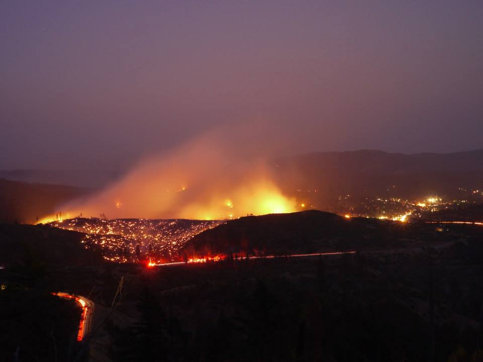
UPDATE 8:39 p.m.: Here is an image that shows the fire right after it started about 4:30 p.m..
Just after the fire started around 4:30 p.m. [Photo provided by Rebekah Gobin Harmon]
UPDATE 8:32 p.m.: Yuba.net is listing the fire at 650 acres.
UPDATE 8:27 p.m.: Rachel Dhe posted a photo on our Facebook and the following explanation, “We are sitting at the west end of town, we can see the fire. Cal Trans says we will be escorted through by CHP.”

UPDATE 8:23 p.m.: KRCR Reporter tweeted,
#Breaking Weaverville High School and Weaverville Elementary will be closed tomorrow due to #OregonFire. @KRCR7
— Shay Arthur (@shayarthur) August 25, 2014
UPDATE 8:14 p.m.: Trinity County Sheriff just sent out this information,
On August 25, 2014 starting at 8:00AM, the Red Cross evacuation center will be moving to the Weaverville First Baptist Church located on Highway 299 across from Mountain View Rd.
UPDATE 8:11 p.m.: Incredible video shot by KRCR News. Click here.
UPDATE 8:04 p.m.: Caltrans in the area is tweeting,
SR299 is open to one way traffic control with CHP pilot car though still subject to closure at any time.
— Caltrans District 2 (@CaltransD2) August 25, 2014
UPDATE 7:44 p.m.: Trinity County Sheriff’s Office just added additional evacuations. They wrote,
Additional MANDATORY evacuations are as follows: Kelso St, Mulligan St, Willow Ave, Manzanita St, Reservoir Rd, Town Reservoir Rd, Tom Bell Rd, Angel Hill Rd, Brashaw Rd, Benoist Ln.
UPDATE 7:33 p.m.: Cal Fire tweet:
#OregonFire [update] off Hwy 299, near Weaverville (Trinity County) is now 450 acres.
UPDATE 7:26 p.m.: Wildland Fire says scanner reports are indicating, “Per [Incident Commander,] 450 ac burning toward area of Weaverville Airport and Hwy 3 at this time. 30 to 45 min before Airport is expected to be impacted by the fire.”
UPDATE 7:17 p.m.: Reports from readers indicating that some traffic is getting through. Pilot cars are escorting traffic.
UPDATE 7:08 p.m.: Two photos provided by Jim Irving who is stuck on Oregon Summit. The view is looking east.
UPDATE 7:05 p.m.: Smoke on the Satellite and radar. Image provided by the US National Weather Service.
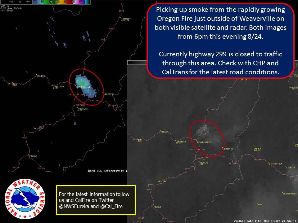
UPDATE 7:01 p.m.: Caltrans says, State Route 299 is closed from three miles west of Weaverville to the Junction of State Route 3 in Weaverville.
UPDATE 6:43 p.m.: Aircraft fighting the Oregon Fire:
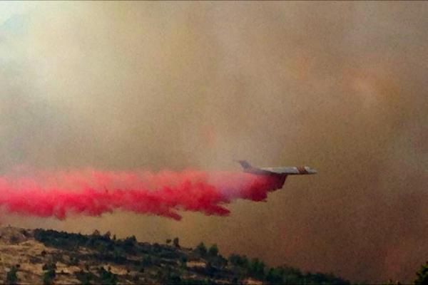
From a reader.
UPDATE 6:39 p.m.: Trinity County Sheriff press release:
The Trinity County Sheriff’s Office is issuing a mandatory fire evacuations for the following Weaverville areas:
Leslie Lane, Weaver Bally Rd, Weaver Bally Estates, Fisher Price Lane, Ridge Rd, Easter Avenue, Barbara Avenue, Garden Gulch, Browns Ranch Rd, Squires Lane, East Weaver Creek Rd, Airport Rd, Brooks Lane, Squires Lane.
The Red Cross evacuation center is located at the Weaverville Elementary School.
UPDATE 6:34 p.m.: Cal Fire tweet:
#OregonFire [update] off Hwy 299, 2 miles west of Weaverville (Trinity County) is now 300 acres. Evacs for Weaver Bally Loop & Victory Lane.
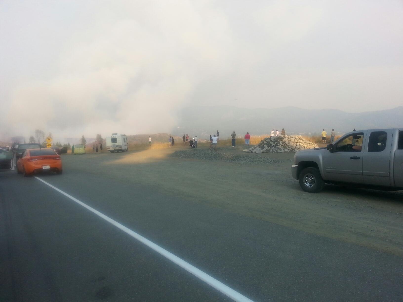
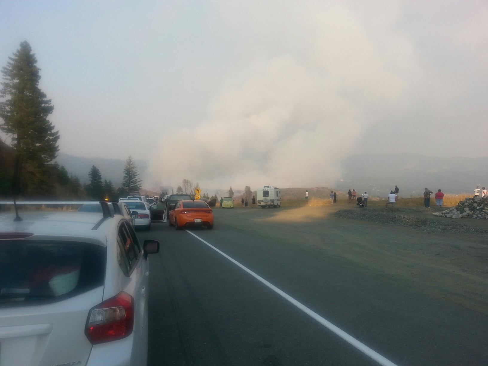
 Homes threatened by the fast growing fire.[Photo provided by a reader.]
UPDATE 6:27 p.m.: Map from here.

UPDATE 6:22 p.m.: Cal Fire is now saying 200 acres! Hwy 299 now closed.
###
Original post:
A fast growing blaze has blown up two miles west of Weaverville. The first report came at 4:25 today. Cal Fire says the burn (known as the Oregon Fire) is already 40 acres. CHP dispatch reports that a boat may have come off its trailer sending up a spark that started the incident. The dispatch also says that evacuation notice is going out to some residents in the area.
According to CHP, eastbound 299 is being closed at the Oregon Summit.
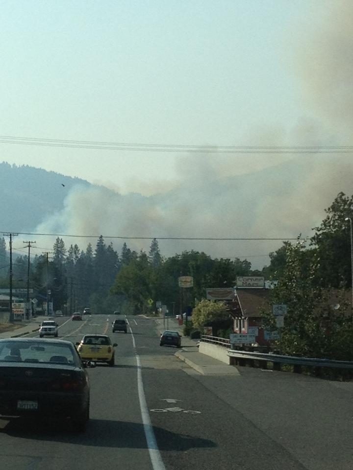
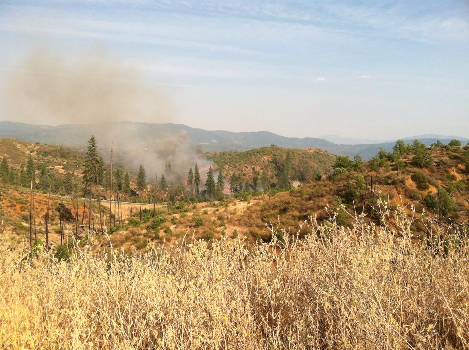
Smoke seen from the main street of Weaverville. [Photo provided by a reader.]
Join the discussion! For rules visit: https://kymkemp.com/commenting-rules
Comments system how-to: https://wpdiscuz.com/community/postid/10599/