
A New Fire Heats Up–The Corral Complex in Eastern Humboldt
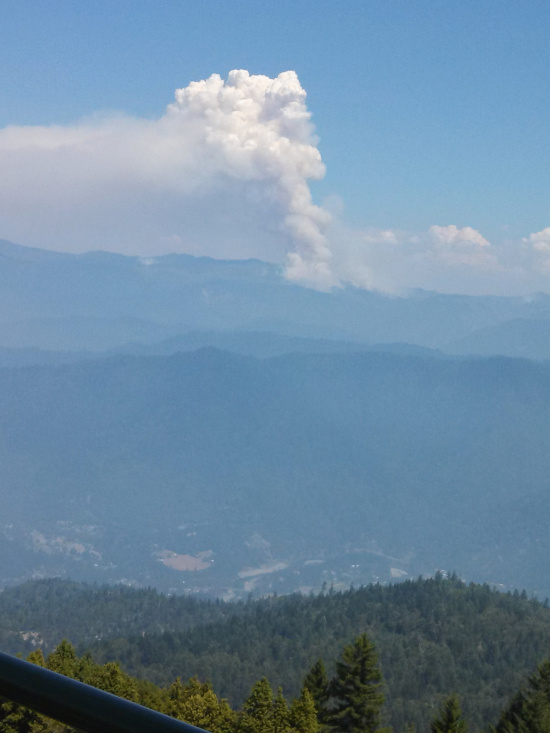
View of the Corral Complex from the lookout on Brush Mountain taken today. The town of Willow Creek is visible between the lookout and the fire. (Photo by Peggy Phillips.)
Smoke has poured into Humboldt in the last few weeks. Some of it has come from Oregon but much from the Orleans and Salmon River Complexes near the Humboldt/Siskiyou border. A new series of fires from lightning strikes last weeks has added another source of smoke–the Corral Complex.
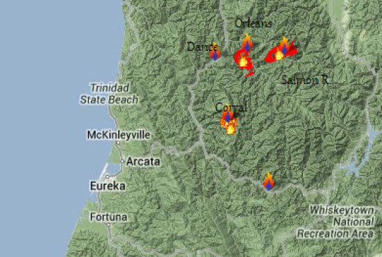
Screen grab of part of the InciWeb Map of Fires in and near Humboldt with added labels. It shows where the major fire complexes are located.
The Corral Complex began Saturday from a lightning storm that struck started several fires. (See below for map of the various fires that make up the complex. The main area burning is in the same area as the 1999 Megram Fire which is east of the Hoopa Reservation. Altogether the fires have burnt over 800 acres so far.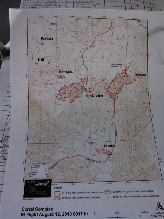
Map showing the various fires that make up the Corral fire. (Photo by Peggy Phillips.)
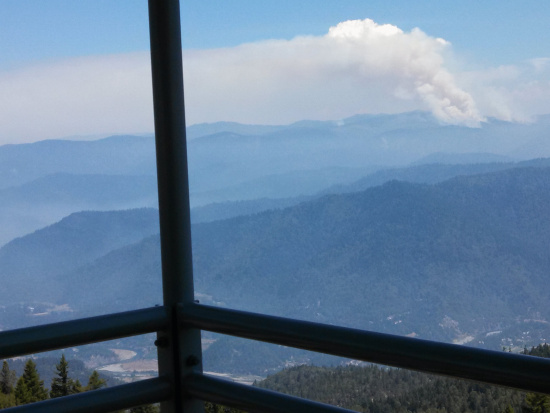
This was taken yesterday and through the haze can be seen columns of smoke from the differing fires in the Corral Fire. (Photo by Peggy Phillips.)
According to the InciWeb, hotshot crews are opening up nearby trails and scouting for potential control lines. By Wednesday, Southern California Interagency Management Team 2 will arrive to take over managing firefighting for the complex.
Join the discussion! For rules visit: https://kymkemp.com/commenting-rules
Comments system how-to: https://wpdiscuz.com/community/postid/10599/